See The Scale

❊ Footprint

How Big Is the Proposed Facility?

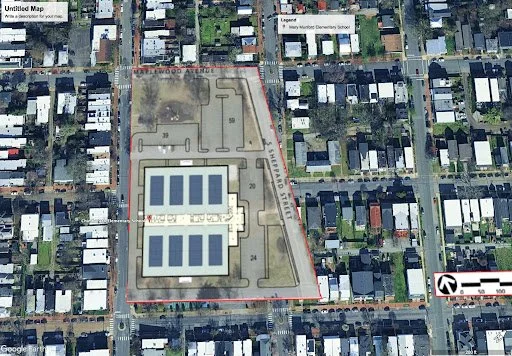
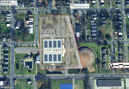
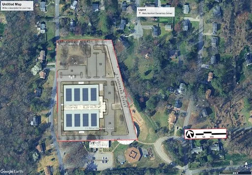
The proposed indoor tennis complex would include eight courts and multiple parking lots, a footprint large enough to cover nearly the entire field behind Lois Harrison-Jones Elementary. To help visualize its scale, we’ve layered the proposed facility outline over satellite images of other Richmond public schools.

What becomes clear is that this is not a neighborhood-sized project, it’s an oversized private complex that would consume a vital piece of public school land.

Aerial view of a school complex with multiple buildings, parking lots, and surrounding neighborhood streets.

Bellevue Elementary

Aerial view of a school campus with two large outdoor solar panel installations in the center, surrounded by a playground and athletic fields, located in a residential neighborhood.

Chimborazo Elementary

Aerial view of Mary Murgatroyd Elementary School with surrounding residential neighborhood, streets, parking lot, and outdoor sports fields.

Holton Elementary

Aerial view of a school building with solar panels on the roof, surrounded by residential houses and streets. The school is enclosed within a red boundary.

Obama Elementary

Aerial view of Mary McLeod Bethune Elementary School with solar panels on the roof, a nearby circular playground, tennis courts, and surrounding residential area.

Blackwell Elementary

Satellite map showing Mary Murph Elementary School with surrounding residential area, trees, and streets. The school grounds include multiple field areas and parking lots.

Fisher Elementary

Satellite view of a school campus with multiple buildings, parking lots, and surrounding residential neighborhoods. The school has solar panels on the roof.

MJJ Elementary

A satellite map showing a school with a playground, surrounded by trees and residential houses, with labeled streets and a legend for nearby Mount Carmel Cemetery School.

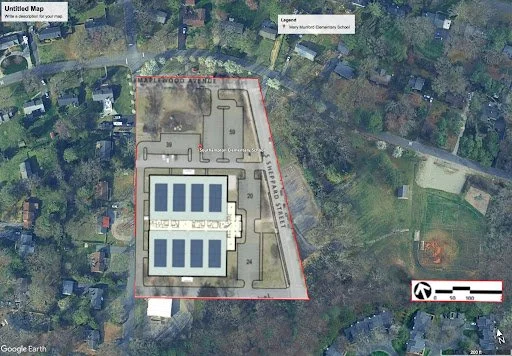
Southhampton Elementary

Aerial view of a school complex with multiple buildings, parking lots, and surrounding residential neighborhood. The map includes a legend and scale.

Broad Rock Elementary

Aerial view of a school complex with multiple buildings and sports fields, surrounded by residential neighborhoods.

Fox Elementary

Aerial view of a school complex with multiple buildings, sports fields, and surrounding residential neighborhood.

Munford Elementary

Aerial view of a school building with multiple parking lots, surrounded by residential houses and streets.

Swansboro Elementary

Take Action Now ▸